Posts

Showing posts with the label BST

Grove Creek - Battle Creek Loop, 8.5

Image
I met up with Sean for the middle section of his 14-miler (Dry Canyon - Grove Creek Loop).  I parked at the mouth of Battle Creek and caught Sean who had started twenty-five minutes early at Dry Canyon.  We followed the dirt roads north along the bench to Grove Creek, ran up the steep Grove Creek trail to Indian Springs (One of my favorite places in all of Utah County), and then I let him continue along the Curly Springs Trail to Dry Canyon while I ran down Battle Creek and returned home just in time to help shuttle kids to soccer games. My phone crashed half way through, and I forgot to start my watch, so I don't have the exact mileage or a map.  I have done this run backward several times - click here for that to see that info.  Indian Springs

Rock Canyon to the "Y" and Back

Image
I met up with Eric and his crew for a run from Rock Canyon to the Y and back. This was the first time I have started at Rock Canyon to run the Y.  The 1.5 miles along the Bonneville Shoreline Trail was a good warm-up before hitting the steep uphill to the top of the Y.  At the top, we met some visitors from Philadelphia who were in town for an Imagine Learning conference.  I enjoyed hearing then talk about the scenery and was reminded of how fortunate I am to have fifty or more amazing trails within fifteen miles. The BST on the way back was no stroll in the park, with several decent-sized rollers. Mentally, I felt like I was done when I made it to the Y parking lot.  The jaunt back to Rock Canyon at the break of dawn was enjoyable nonetheless. Overall, we gained 1,740 feet in elevation over the 5.6 miles - a great way to start the day! Sean, Monte, Eric Sean ran a trail half marathon last weekend, so he decided to take it a little slower this mor...

Bonneville Shoreline Trail from Springville Running North - in Snow

Image
This is a great trail with lots of rollers for a good workout!  We just had our first BIG snow storm, so we were the first to break through the powder.  We saw 20 or 30 deer.  And the view of the valley with fresh snow was fantastic.   Sean at our turn-around spot. I believe this is an old mine. This guy looks like TROUBLE!

Spanish Fork Canyon to Bonneville Shoreline

Image
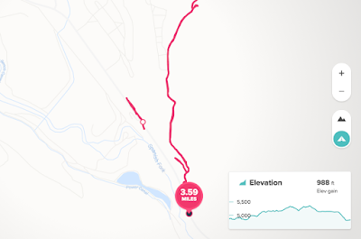
I found a way to connect to the Bonneville Shoreline Trail from Highway 6, at the mouth of Spanish Fork Canyon.  Just east of the monstrous windmills you will see a horseshoe pull-off on the left (north). There is a vague, steep and rocky double track trail that climbs to a power line trail.  It's just over 1/4 mile to the trail (.29 to be exact).  This is a good, wide roller coaster trail that goes for about 4 miles until it meets Mapleton Canyon.  I turned around about half way to Mapleton. You can see that I originally started at the first pull-off on the right.  After a short run along the highway, I realized connecter trail was a little farther up the road.  You can't miss the horseshoe pull-off on the north.  I wish I had taken a camera with me.  The view looking down SF Canyon at the windmills, and the valley all the way to Utah Lake was pretty spectacular.  The frigid canyon wind was not as enjoyable. Kevin Rowe was kind enou...

Dry Canyon Trail 051 (7.3) - Lindon, Utah

Image
The Trailhead: Take the 1600 N Orem/Lindon Exit and head east. Turn left on Skyline Drive and then right on Dry Canyon Road. 31 minutes from East Spanish Fork (my home). There are many trail options from this trailhead.  We chose a great one: Trail 051.  After a 3/4 mile steep climb turn right and switch back up to a beautiful view of Lindon/Orem.  This trail takes you South before heading further east for a spectacular view of Provo Canyon, Mount Baldy, and Timp. Trail 51 comes out at the Orem water towers.  Take the Bonneville Shoreline Trail back to Dry Canyon Trailhead. Here are some pics.  Watch the sky change as the sun comes up.