Posts

Showing posts from June, 2015

Hidden Oak Trail - Above Spanish Fork Reservoir

Image
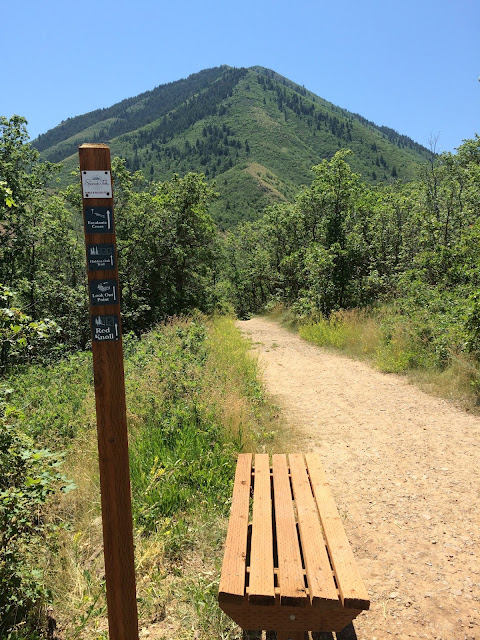
On a 93 degree day, this trail was the perfect choice.  The Hidden Oak Trail (also known as Snell Canyon) starts at the end of the road just east of Spanish Oaks Reservoir. Most of the trail is through thick oak and pine trees, so it is very shaded.  Bring your bug spray as there were a lot of flies and gnats, particularly the first half mile. It's only 1.25 miles to the overlook , but it feels further because of the climb.  From that point the trail gradually starts to disappear in the tall grass and shrubs, though many people will bushwhack much further up Snell Canyon. Highlight: playing with a spotted fawn who kept running up the trail and then waiting for me to catch up.  The trail is a gradual climb until just over one mile, at which point there are two steep switch backs leading to an amazing view of the Spanish Fork City and River Bottoms.   Other fun trails in this area include: Look Out Point, Escalante Cross, and Red Knoll

Long Hollow to Monks Hollow #125 - Spanish Fork Canyon

Image
Long Hollow was a surprisingly beautiful trail that led to overlooks of Mount Nebo and Spanish Fork Peak from the East.  We went out and back.  Next time we'll park at Monks Hollow and run straight through (and shuttle back).  It was hard to turn around at mile six.  (See below for directions to the trailhead.)  It was quite a climb!  I don't think we were expecting the 2,700 foot ascent, or the time it would take to run this trail.  We were a little late getting to the office after this one, but the views were worth the early wake-up.     Spanish Fork Peak from the East  Cruising on the downhill  Great view of Spanish Fork Peak  Although we were thirsty at this point, we resisted taking a drink.  The truck was a welcome sight.  (This is right off Highway 6) Directions: From I-15 Drive East on Highway 6 toward Price. The trailhead is on the left, j

Wasatch Back Ragnar

Image
"200-ish" miles in just under 35 hours with 12 people. Source: https://www.ragnarrelay.com/race/wasatchback/legs Below are maps and stats from my three legs, followed by a few pics.  Straight up Old Snow Basin  A quick 5AM run in Wanship after almost 3 hours of sleep Straight Down "You've Gotta Be Kidding Me" and into Midway Traffic jam at the top of Ragnar. The whole team minus Kurt (who was running his final leg, straight up Deer Valley Mountain) Middle of Keith's HOT run The team minus Jo, who was running her las leg - over the top of Park City Mountain Cheering on Keith Jo approaching exchange 18 in the wee hours of the morning. Approaching the top of Snow Basin Notice the photo bomb - That's me. Garrett was an animal.  He's a great runner. Todd finished strong.  He was amazing! Van 2 at the finish I don't think the matching vehicles was on purpose, but it s