Posts

Showing posts from August, 2016

Sam’s Shooter Trail, 7.5

Image
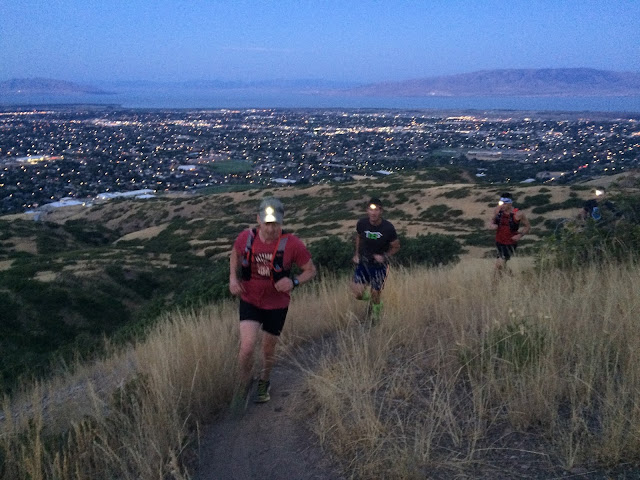
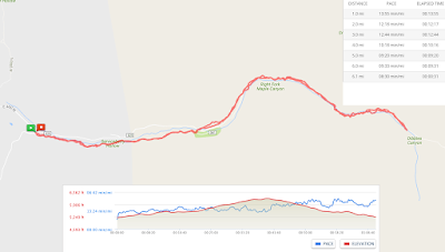
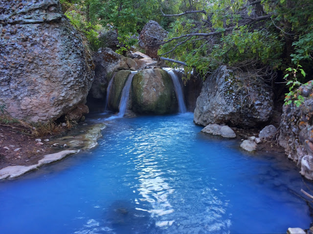
The Sam’s Shooter Trail is a fun one that twists around above the Orem Police Gun Range then works its way over to Provo Canyon.  It’s 7.5 miles and 1264’ of climbing.  We did it in 1:18.  The trail starts at the Orem Police Gun Range (the BST trailhead above the Orem Cemetery and Water Treatment Plant).  This was a great group and we got some amazing pics.  Watch the colors change as the sun comes up. Eric, Scott, Sam, and Sean Scott and Sam (This trail is named after Sam) Sean, Sam, Eric, Scott Five trails intersect at "The Alter". This map shows how easy it is to take a wrong turn. There are many trails in this area, but I think the one we did this morning was among the very best.

Maple Canyon - To the Bridge and Back, 6.0

Image
Great trail.  Beautiful morning.  The leaves are turning colors already. Brian and Sean Turn-a-round point I can't believe it is fall already.

Pole Canyon Loop from Bridal Veil Falls, 7.3

Image
Sean invited me to join his group of engineers for a beautiful run and a fantastic new trail this morning.  We started on the Bonneville Shoreline Trail from the Bridal Veil Falls parking lot (just west of Bridal Veil Falls).   After just over two miles on the BST (just past the archery range dirt road), we took a left on a lightly traveled single track trail up Pole Canyon.  That trail looped around and eventually came back to the BST.  It was enjoyable to meet up with a great group of trail runners and to have them show me this new side trail.  It is a fun loop. I will do it again. Minor casualties. One day I'll learn to put away my phone and run.

Hot Pots with the Spanish Fork Cross Country Team (AKA 5th Water), 4.75

Image
I love this trail, and it was even better with a bunch of fantastic high school cross country runners. What a great team! The water seemed particularly blue today.  It was beautiful...and made up for the sulphuric stench. These athletes have a great coach!